
Walk a Magna Street Record by Record
A street-level search should move from place to person evidence in a set order. The county property system gives a parcel and published owner context. The Parcel Viewer confirms the mapped location and lets a researcher select adjoining parcels. The Recorder then supplies document references, while Utah’s voter forms and historical Polk street sections answer narrower questions about registration or past householders. None is a complete list of who is inside a home.
- Enter the Magna address in the Salt Lake County Assessor search, using address autocomplete or the parcel number when available.
- Open the Parcel Viewer and confirm the street, parcel, map position, and neighboring selection.
- Use Utah Voter Search for a voter’s own check, or identify the lawful data route, instead of treating the address form as a complete street roll.
- Search the Recorder with the address or parcel, recording parties, instrument type, date, and book, page, or entry reference.
- For past households, check the library’s Polk alphabetical, householder or street, and classified sections, then compare a second source.
Magna Records You Can Search by Street
Address-keyed records answer different parts of the street-directory question. The Assessor’s result is a property and tax record. GIS shows spatial relationships. A deed index records parties to an instrument. Voter information is governed by Utah privacy rules. Magna building and licensing work routes through the Greater Salt Lake Municipal Services District and Cityworks, where the public pages describe permit, inspection, result, comment, and certificate functions but do not supply a located searchable resident register.
| Record Set | Keeper | What It Shows | Access |
|---|---|---|---|
| Property and tax roll | Salt Lake County Assessor | Published owner, property location, parcel context | Free portal |
| GIS parcel map | Salt Lake County GIS | Parcels, map position, buffers, historic imagery | Free viewer |
| Deeds and liens | Salt Lake County Recorder | Recorded parties, document type, sale or lien trail | Free search, paid copies or data |
| Voter information | Salt Lake County Elections / Utah | Defined registration fields and vote history | Privacy and access rules |
| Permits and licenses | MSD / Cityworks | Applications, inspections, results, comments, certificates | Portal availability varies |
The parcel number is the best bridge between the property roll, map, and Recorder search. A street name helps with an address, but it is not a unique identity key. Keep a short log with the exact address, parcel, source, search date, and record meaning. That protects against merging two people with similar names or two parcels with similar street descriptions.
Salt Lake County’s Treasurer search is another address-linked source, but it is a tax-account tool rather than a resident directory. Its form requires a date and can accept an address autocomplete or parcel number. Online payments post the next business day, and nightly maintenance is listed from 11:55 p.m. to 5:00 a.m. Mountain Time. Use it when a tax account or payment trail is the question, not when the goal is to list a street’s households.
For a permit or certificate question, the city routes the search to MSD and Cityworks. The building-services description includes applying, printing a permit, downloading stamped drawings, scheduling an inspection, viewing results or comments, and printing a certificate. Because the external fields were not fully rendered in research, verify what the live portal exposes before promising a result.
Magna Assessor Search Fields
The current county Assessor search accepts an owner last name and first name, an address selected from autocomplete, or a parcel number displayed in the form’s 00-00-000-000-0000 pattern. The older legacy form is useful when a street clue is partial. It asks for the first three letters of an owner name, frontage, direction, street name and number, type, and direction. It also accepts the first ten parcel digits with four optional encumbrance digits.
| Owner | First and last name, or first three last-name letters in the legacy form |
|---|---|
| Address | Frontage, direction, street name, number, type, and direction |
| Parcel | Parcel number, with optional encumbrance digits on the legacy search |
| Result | Search, sort a list, open detail, and compare the mapped property |
Save the property location and parcel, not just a person name. The county cautions that property information may be at least 24 hours old, so a street directory result needs a capture date.
The legacy Assessor query is especially useful when an old address has a direction or street-type variation.
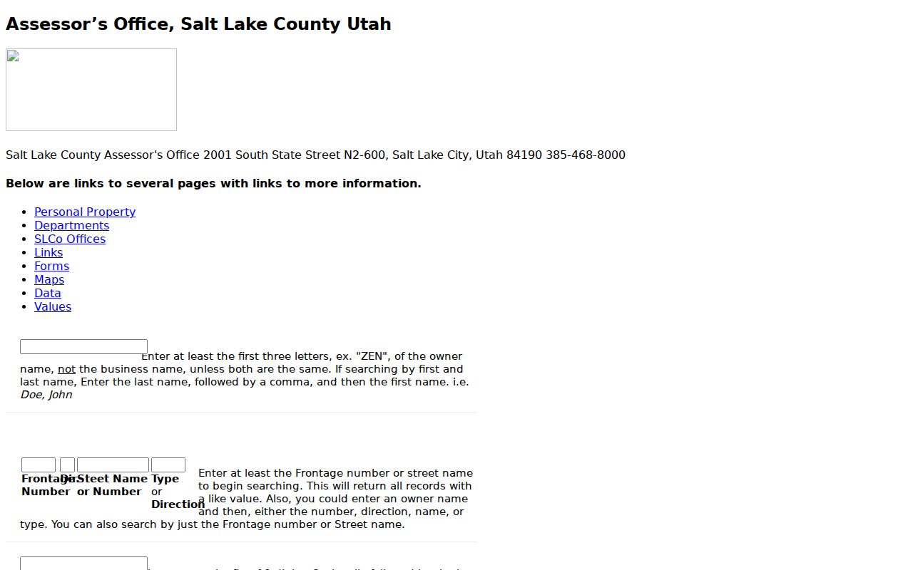
The screenshot shows why a careful address search can recover a record that a modern autocomplete entry does not.
Mapping Magna Parcels Along a Street
The Salt Lake County Parcel Viewer supports Find Parcel Number, Owner, and Address entry. Once a map is open, a researcher can select a parcel, draw a line or polygon, identify multiple parcels, or buffer a point or parcel by a distance in feet. Street, aerial, and topographic layers are available, along with 2012–2014 historic imagery and PDF, JPG, PNG, GIF, EPS, and SVG export choices.
Use the map to define “nearby,” then open each parcel record separately. The viewer has a first-1,000-result limit and a one-time-capture disclaimer. Those limits matter on a broad Magna search. County GIS explains that parcel information is supplied by the Recorder, while Utah’s statewide parcel layer is a snapshot with different update dates and fewer county attributes.
The Magna parcel-viewer state provides the map and property controls used for street research.
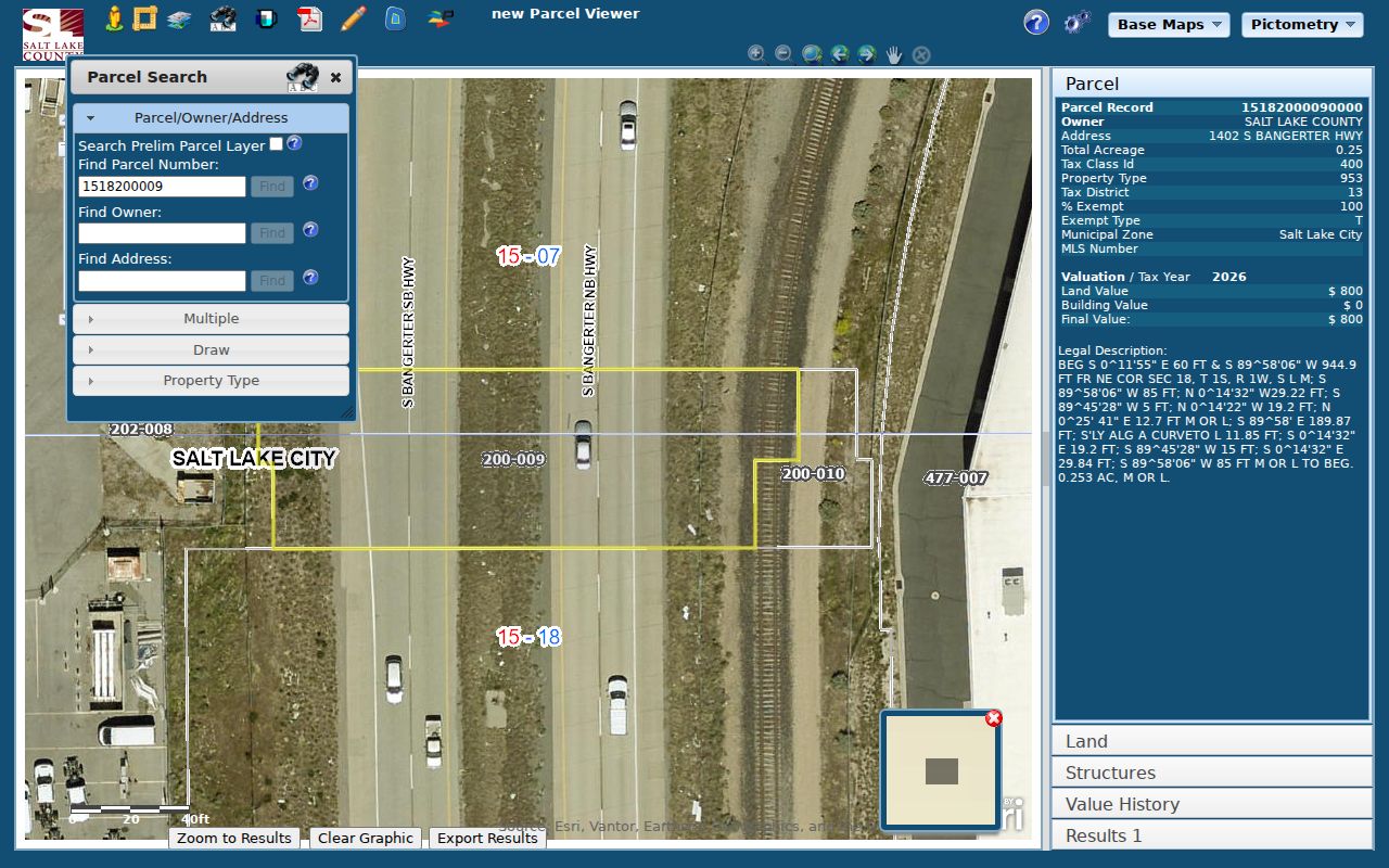
Map proximity is useful context, but each owner or address claim still needs its own official record.
Deed Links Along a Magna Street
Salt Lake County Recorder’s free public search asks for an address or parcel selected from autocomplete after the search agreement is accepted. The index can point to deeds, plats, easements, mortgages, releases, liens, and other recorded instruments. A document party is tied to that instrument, not automatically to a home’s occupants.
Free indexing and paid acquisition are separate. A 24-hour temporary account supplies up to 150 data units for $5; larger packages are available through the county’s data-services page. One unit covers a search or abstract, one covers each document page, and plats or maps use 20 units per page. The document-request route lists ordinary pages at $2, historical or vault pages at $5, ownership or description printouts at $1, plus certification charges.
The Recorder public-search entry is the right starting point for a street address or parcel.
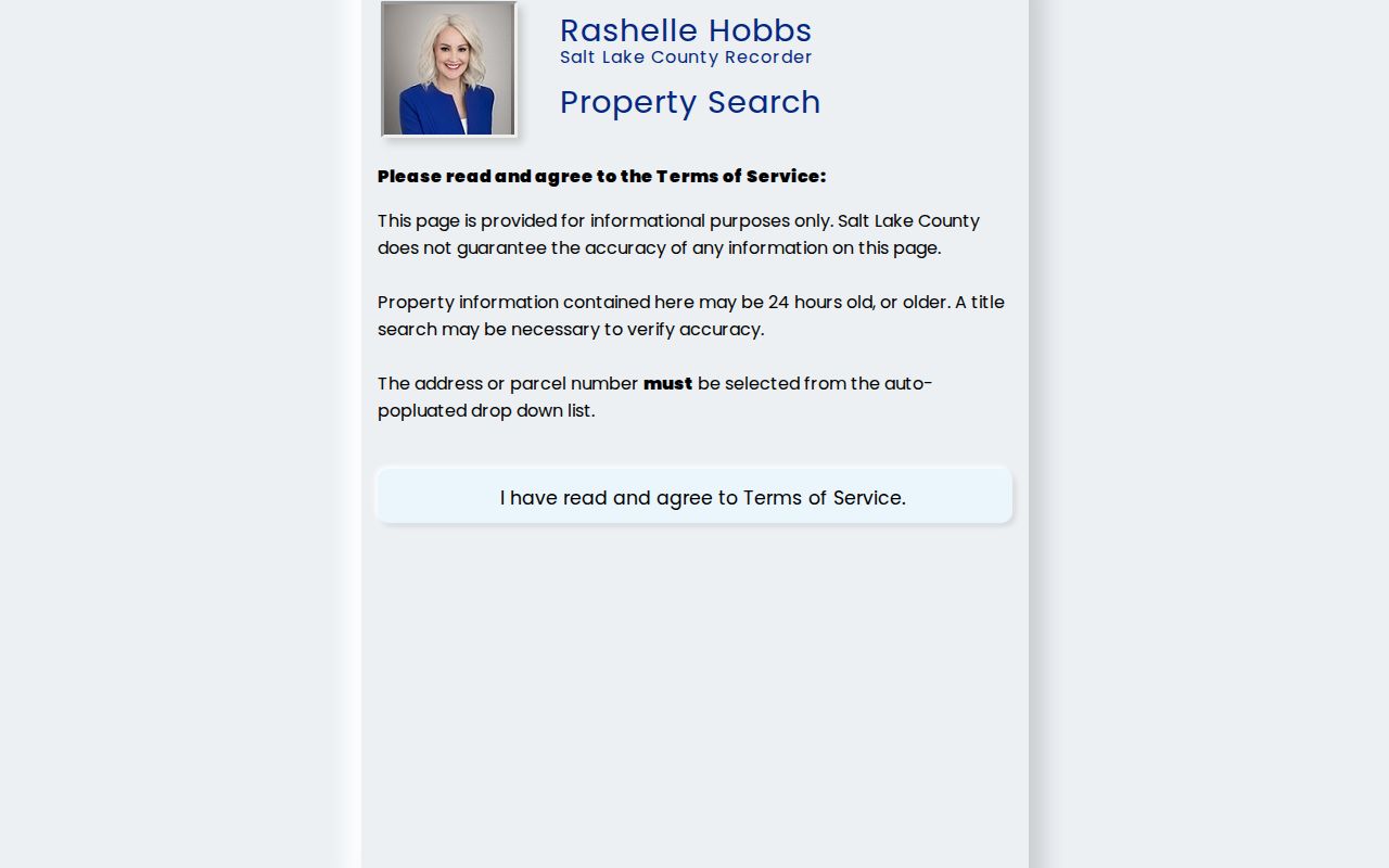
For a copy, the request form accepts partial clues such as party, date, document type, book/page/index, property, or parcel information, with pickup or email delivery options described by the office.
Old Magna Street Names and Boundaries
Older street research can fail when a record uses a historical place label. Magna’s history includes Pleasant Green, Ragtown, Greektown, Japantown, Snaketown, and Little Italy, while industrial terms include Utah Copper Company, Magna Mill, Boston Consolidated, Arthur Mill, Hercules Powder, and Bacchus Works. Search the street guide with Magna, Pleasant Green, township, CDP, and Salt Lake County vocabulary when a modern city query returns nothing.
The 2007 West Bench plan describes historical Magna as an unincorporated township bounded by the Great Salt Lake and Salt Lake City boundary to the north, about 4100 South to the south, 7200 West to the east, and the Oquirrh Mountains to the west. Treat that as historical planning context. Magna’s current Planning page routes address and jurisdiction questions to the MSD Planning Information Finder and Address Lookup.
For a street-history visual, the Salt Lake County GIS information page explains how parcel layers relate to the Recorder source.
Use current GIS and service-jurisdiction tools for present questions, then use historical maps for context.
Address Terms for Magna Research
Four terms help keep a by-address result precise.
- Parcel
- A mapped land unit identified by a county number and legal description.
- Situs address
- The physical location of a property, which can differ from a mailing address.
- Plat
- A recorded map that shows lots, lines, streets, or changes to a subdivision.
- Criss-cross directory
- A historical volume arranged by street or address, useful for dated household research.
These labels explain why a street directory can connect several records without producing one current occupant list.
Limits of a Magna Street Directory
A street directory cannot promise every occupant, renter, household member, phone number, or current address. DMV address information is restricted by the federal Driver’s Privacy Protection Act, and utility or delivery customer data is not a public street roll. Voter data has public fields but also protected categories and omissions. A historical household entry is fixed to its publication date.
When an address does not appear, test directionals, street type, unit information, and the historical place label. Search Magna, Pleasant Green, township, CDP, and Salt Lake County when the period calls for it. Also ask whether the desired record is held by the city, MSD, county, district, or state. A failed portal search often reflects a jurisdiction or format mismatch rather than an empty history.
Lawful use. Magna address records are for personal, lawful research, family history, property curiosity, and civic use. Never use a street or name result to stalk, harass, intimidate, or harm anyone.